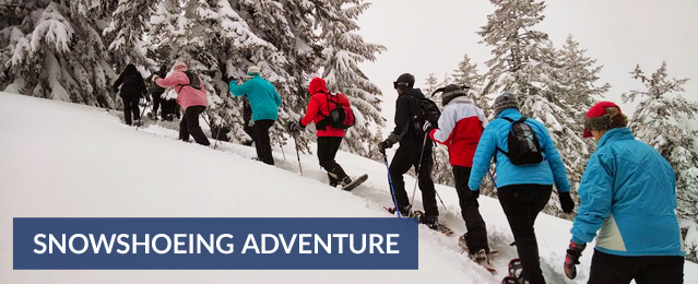
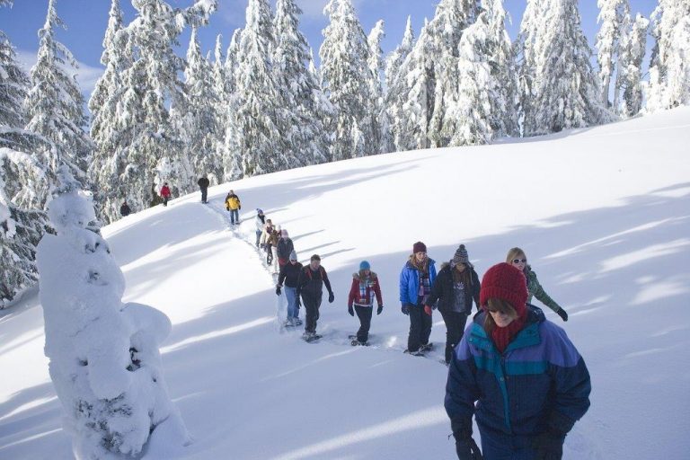
Tips for snowshoeing:
A pair of snowshoes can find you into a Colorado winter wonderland with snow-filled trees, peaceful white meadows and trails running next to frozen creeks. There are More than 20 Colorado Nordic centers, 42 state parks and 11 national parks which are a sure way to get you snowshoeing and start discovering and having a fun winter in Colorado.
Click Here for Winter Adventure Tours
Basic equipment needed for snowshoeing:
- First layer: wool socks, top and bottom thermal underwear
- Second layer: long-sleeved shirt or fleece jacket
- Outside layer: Waterproof jacket, gloves or mittens, snow pants and hiking shoes or boots, wool hat, snowshoes
- Other items: Polarized sunglasses or goggles; Camelback or other water system, ski or trekking poles; gaiters, daypack with extra socks, sunscreen, first-aid kit, camera, snacks
Snowshoe sizes:
The size of a snowshoe is dependent on weight, not only yours but what you will be packing as well.
- 100 to 150 pounds = 20- to 22-inch snowshoe
- 140 to 200 pounds = 25- to 26-inch snowshoe
- 200 to 230 pounds = 30-inch snowshoe
- 230+ pounds = 35- to 36-inch snowshoe
Remember if you can walk you can snow shoe.
Colorado Snowshoe Trails:
-
Brainard Lake
Brainard Lake is Often described as one of the most popular area’s for cross-country skiing and snowshoeing in all of the Front Range, the area has numerous options for both cross-country skiers and snowshoe’s Ward, CO – Snowshoeing – 5.4 miles
Trail Statistics & Information
- Activity Type: Snowshoeing
- Nearby City: Ward
- Length: 5.4 total miles
- Elevation Gain: Minimal
- Trail Type: Out-and-back
- Skill Level: Novice
- Duration: 3 hours
- Trailhead Elevation: 10,080 feet
- Local Contacts: Brainard Lake Recreation
-
Lost Lake
Lost Lake is Popular because of how close it is to Denver and Boulder, the area has numerous trails. The hike to Lost Lake is a fun outing for any level skier or snowshoer who wants to appreciate the beauty of Colorado. Nederland, CO – Snowshoeing – 6 mile
Trail Statistics & Information
- Activity Type: Snowshoeing
- Nearby City: Nederland
- Length: 6 total miles
- Elevation Gain: Minimal
- Trail Type: Out-and-back
- Skill Level: Novice to intermediate
- Duration: 3 to 4 hours
- Trailhead Elevation: 8,810 feet
- Top Elevation: 9,780 feet
- Other Uses: Moderate snowmobile use
-
Chinns Lake
Though conveniently close to Denver, this tour in the shadow of the Continental Divide is typically uncrowded. The trailhead to Chinns Lake lies within one hour of Denver, but the route is typically uncrowded. Idaho Springs, CO – Cross-Country Skiing – 7.4 miles
Trail Statistics & Information
- Activity Type: Cross-Country Skiing / Snowshoeing
- Nearby City: Idaho Springs
- Length: 7.4 total miles
- Elevation Gain: 1,580 feet
- Trail Type: Out-and-back
- Skill Level: More Difficult; Avalanche Danger: Moderate
- Duration: 130 minutes up, 50 minutes down
- Season: Mid-November to late March
- Trailhead Elevation: 9,560 feet
- Top Elevation: 11,040 feet
- Other Uses: Good for: dogs
- Local Contacts: Arapaho National Forest
-
Peaks Trail (Breckenridge to Frisco)
After you have heard or read about the Peaks Trail, chances are you will give this beautiful, but challenging tour a try. This is one of those Colorado tours which you will hear about a great deal, since the views are spectacular. The trail goes either from Frisco to Breckenridge or in reverse. The trail is below the Ten Mile Range peaks 1-10 and is a photographer’s dream. Frisco, CO – Cross-Country Skiing/snowshoeing – 8.5 miles
Trail Statistics & Information
- Activity Type: Cross-Country Skiing/Snowshoeing
- Nearby City: Frisco
- Length: 8.5 total miles
- Elevation Gain: 1,285 feet
- Trail Type: Point-to-point
- Skill Level: Most Difficult; Avalanche Danger: Moderate
- Duration: 177 minutes
- Season: Early December to late February
- Trailhead Elevation: 10,030 feet
- Top Elevation: 10,240 feet
- Local Contacts: Arapaho National Forest (Dillon Ranger District)
-
Bear Lake
Rocky Mountain National Park is 265,727 acres of amazing mountain scenery, including one of the “Fourteeners”—Longs Peak at 14,255 feet. In the park you might have the opportunity for several wildlife sightings, Elk, Moose, Dear, etc. Estes Park, CO – Snowshoeing – 3.6 miles
Trail Statistics & Information
- Activity Type: Snowshoeing
- Nearby City: Estes Park
- Length: 3.6 total miles
- Elevation Gain: Minimal
- Trail Type: Out-and-back
- Skill Level: Novice to intermediate
- Duration: 3 to 4 hours
- Trailhead Elevation: 9,475 feet
- Top Elevation: 10,230 feet
- Other Uses: Ice Fishing
- Local Contacts: Rocky Mountain National Park
-
4th of July Road to Buckingham Campground
This is a time consuming snowshoe into the beautiful Indian Peaks area which offers a rare opportunity in winter to see bighorn sheep. . You will snowshoe on a wide, not to steep uphill road, which ends at the Buckingham Campground and the trailhead to Arapaho Pass and Diamond Lake. Don’t continue up, as the avalanche danger is considerable on those trails. The road can be icy in the first half mile and it is typically windswept. Nederland, CO – Cross-Country Skiing – 9.8 miles
Trail Statistics & Information
- Activity Type: Cross-Country Skiing
- Nearby City: Nederland
- Length: 9.8 total miles
- Elevation Gain: 1,426 feet
- Trail Type: Out-and-back
- Skill Level: More Difficult; Avalanche Danger: Least
- Duration: 130 minutes up, 100 minutes down
- Season: Early January to late February
- Trailhead Elevation: 8,820 feet
- Top Elevation: 10,170 feet
- Other Uses: Good for: wildlife
- Local Contacts: Roosevelt National Forest
-
Corral Creek
If you want to get a head start on cross-country skiing or snowshoeing , this is a great trail because it is in one of the areas that gets lots of snow early. Here you can enjoy snowshoeing without the noise of snowmobiles as with the shrine mountain area across the highway on westbound Vail, CO – Snowshoeing – 5 miles
Trail Statistics & Information
- Activity Type: Snowshoeing
- Nearby City: Vail
- Length: 5 total miles
- Elevation Gain: Minimal
- Trail Type: Loop
- Skill Level: Novice to intermediate
- Duration: 3 to 4 hours
- Trailhead Elevation: 10,550 feet
- Top Elevation: 11,000 feet
- Other Uses: Moderate snowmobile use
- Local Contacts: White River National Forest
-
Deer Creek
Great early season snow and lots of trails to choose from, this area has become a haven for snowshoers and skiers. Montezuma, CO – Cross-Country Skiing – 4.6 miles
Trail Statistics & Information
- Activity Type: Cross-Country Skiing/snowshoeing
- Nearby City: Montezuma
- Length: 4.6 total miles
- Elevation Gain: 880 feet
- Trail Type: Out-and-back
- Skill Level: More Difficult; Avalanche Danger: Least
- Duration: 80 minutes up, 42 minutes down
- Season: Mid-November to late March
- Trailhead Elevation: 10,550 feet
- Top Elevation: 11,400 feet
- Other Uses: Good for: dogs
- Local Contacts: Arapaho National Forest (Dillon Ranger District)
-
Lily Pad Lake
This is a popular trail for Nordic skiers and snowshoers in the Dillon and Silverthorne area in Summit County. Because it starts in the Eagles Nest Wilderness Area, no mechanized vehicles or snowmobiles are allowed. The trail is ideal for beginners, Lily Pad Lake Trail is short, has the gentlest of grades, and goes t through meadows and in and out of stands of spruce and aspen to wind up at the pristine, frozen lake. Lily Pad Lake is ideal for picnicking and taking pictures. Silverthorne, CO – Snowshoeing – 3 miles
Trail Statistics & Information
- Activity Type: Snowshoeing
- Nearby City: Silverthorne
- Length: 3 total miles
- Elevation Gain: Minimal
- Trail Type: Out-and-back
- Skill Level: Novice
- Duration: 1 to 3 hours
- Trailhead Elevation: 9,800 feet
- Local Contacts: White River National Forest
-
Leavenworth Gulch to Waldorf
This beautiful high-alpine basin and lonely ghost town was once a major Colorado tourist destination. It is surprising that this wonderful high-country tour is not better known. Georgetown, CO – Cross-Country Skiing – 12.4 miles
Trail Statistics & Information
- Activity Type: Cross-Country Skiing
- Nearby City: Georgetown
- Length: 12.4 total miles
- Elevation Gain: 2,024 feet
- Trail Type: Out-and-back
- Skill Level: More Difficult; Avalanche Danger: Moderate
- Duration: 178 minutes up, 94 minutes down
- Season: Mid-November to late March
- Trailhead Elevation: 9,560 feet
- Top Elevation: 11,594 feet
- Local Contacts: Arapaho National Forest
-
McCullough Gulch
A photographers dream with four impressive Peaks towering above you. This snowshoe trail takes you up McCullough Gulch, south of Breckenridge. Breckenridge, CO – Cross-Country Skiing – 5.8 mile
Trail Statistics & Information
- Activity Type: Cross-Country Skiing
- Nearby City: Breckenridge
- Length: 5.8 total miles
- Elevation Gain: 662 feet
- Trail Type: Out-and-back
- Skill Level: More Difficult; Avalanche Danger: Moderate
- Duration: 77 minutes up, 66 minutes down
- Season: Mid-November to late March
- Trailhead Elevation: 10,848 feet
- Top Elevation: 11,350 feet
- Local Contacts: Arapaho National Forest (Dillon Ranger District)
-
Boreas Pass (from Breckenridge)
This high mountain pass offers a long but gentile grade, with amazing views. Breckenridge, CO – Cross-Country Skiing – 13.2 miles
Trail Statistics & Information
- Activity Type: Cross-Country Skiing
- Nearby City: Breckenridge
- Length: 13.2 total miles
- Elevation Gain: 1,281 feet
- Trail Type: Out-and-back
- Skill Level: More Difficult; Avalanche Danger: Moderate
- Duration: 150 minutes up, 114 minutes down
- Season: Early December to late February
- Trailhead Elevation: 10,350 feet
- Top Elevation: 11,481 feet
- Local Contacts: Arapaho National Forest (Dillon Ranger District)(from Breckenridge)
-
Keystone Gulch
The Keystone area in Summit County has over 26 kilometers of groomed trails and an additional 50 kilometers of backcountry trails, mostly old mining roads. Keystone, CO – Snowshoeing – 10 miles The trail climbs gradually and becomes too steep for the beginner toward the end where it is recommended for intermediate and advanced skiers and snowshoers. Many skiers or snowshoers stop before the big climb begins and head back about 5 miles from the trailhead.
Trail Statistics & Information
- Activity Type: Snowshoeing
- Nearby City: Keystone
- Length: 10 total miles
- Elevation Gain: 2,460 feet
- Trail Type: Out-and-back
- Skill Level: Novice to intermediate
- Duration: 5 to 7 hours
- Trailhead Elevation: 9,200 feet
- Top Elevation: 11,960 feet
-
Echo Lake
Clear Creek County is close by to Metropolitan Denver and has many winter trails. One of these is the loop around Echo Lake. Echo Lake Park is one of the Denver Mountain Parks. The trail is basically flat, Be aware of the lake and lookout for thin ice. Lamartine, CO – Cross-Country Skiing – 1 mile
Trail Statistics & Information
- Activity Type: Cross-Country Skiing
- Nearby City: Lamartine
- Length: 1 total miles
- Elevation Gain: Minimal
- Trail Type: Loop
- Skill Level: Easy
- Duration: 30 mins
- Season: Winter
- Trailhead Elevation: 10,597 feet
- Top Elevation: 10,597 feet
- Local Contacts: Arapaho National Forest
-
Frazer Meadow
When there is enough snow, Golden Gate Canyon State Park can provide some good snowshoe experiences. Smith Hill, CO – Cross-Country Skiing – 4.6 miles
Trail Statistics & Information
- Activity Type: Cross-Country Skiing
- Nearby City: Smith Hill
- Length: 4.6 total miles
- Elevation Gain: 1,260 feet
- Trail Type: Out-and-back
- Skill Level: Moderate
- Duration: 2 hrs 8 mins
- Season: Winter
- Trailhead Elevation: 8,400 feet
- Top Elevation: 9,200 feet
- Local Contacts: Golden Gate Canyon State Park
-
Alberta Falls
The number of trails near Bear Lake in Rocky Mountain National Park offers many options for both winter and summer trekking. Beaver Point, CO – Cross-Country Skiing – 1.8 miles
Trail Statistics & Information
- Activity Type: Cross-Country Skiing/ snowshoeing
- Nearby City: Beaver Point
- Length: 1.8 total miles
- Elevation Gain: 272 feet
- Trail Type: Out-and-back
- Skill Level: Easy
- Duration: 48 mins
- Season: Winter
- Trailhead Elevation: 9,200 feet
- Top Elevation: 9,400 feet
-
Peru Creek
If you are a beginner skier or snowshoer who wants to take in the rich mining history of the area while enjoying pleasant backcountry snoeshoeing the beginning part of this tour is well suited to see the old mines. Montezuma, CO – Snowshoeing – 8 mil
-
North Tenmile Creek
North Ten mile Creek is an excellent option to snowshoe because there are no motorized vehicles are allowed in the Eagles Nest Wilderness Area. Hence you are alone with scenic canyons that were carved thousands of years ago by glaciers. The trail actually begins at the end of Main Street, great location for an early morning breakfast or a hearty lunch afterwards. Frisco, CO – Snowshoeing – 10 miles
Trail Statistics & Information
- Activity Type: Snowshoeing
- Nearby City: Frisco
- Length: 10 total miles
- Elevation Gain: 850 feet
- Trail Type: Out-and-back
- Skill Level: Intermediate
- Duration: 5 hours to full day
- Trailhead Elevation: 9,400 feet
- Top Elevation: 10,250 feet
- Other Uses: Moderate snowmobile use for first 2.5 miles
- Local Contacts: White River National Forest
-
Hunkidori Mine
This is one of those unique trails with terrain equally suitable for both snowshoers and skiers. Think about a backcountry tour with awesome scenery, some moderate downhill runs for skiers and snowshoers. Silverthorne, CO – Cross-Country Skiing – 7.2 miles
Trail Statistics & Information
- Activity Type: Cross-Country Skiing
- Nearby City: Silverthorne
- Length: 7.2 total miles
- Elevation Gain: 1,310 feet
- Trail Type: Out-and-back
- Skill Level: More Difficult; Avalanche Danger: Moderate
- Duration: 73 minutes up, 68 minutes down
- Season: Late November to early March
- Trailhead Elevation: 10,300 feet
- Top Elevation: 10,990 feet
- Local Contacts: Arapaho National Forest (Dillon Ranger District)
-
Shrine Pass
This is one of those unique trails with terrain equally suitable for both snowshoers and skiers. Think about a backcountry tour with awesome scenery, some moderate downhill runs for skiers and snowshoers. Silverthorne, CO – Cross-Country Skiing – 7.2 miles
Trail Statistics & Information
- Activity Type: Cross-Country Skiing
- Nearby City: Silverthorne
- Length: 7.2 total miles
- Elevation Gain: 1,310 feet
- Trail Type: Out-and-back
- Skill Level: More Difficult; Avalanche Danger: Moderate
- Duration: 73 minutes up, 68 minutes down
- Season: Late November to early March
- Trailhead Elevation: 10,300 feet
- Top Elevation: 10,990 feet
- Local Contacts: Arapaho National Forest (Dillon Ranger District)
Click Here for Winter Adventure Tours
